Traffic Intelligence & Mobility
Applicable across any environment where people, vehicles, or cargo move through shared spaces

Traffic Flow Optimization
AI-driven analysis to reduce congestion and improve mobility

Road Infrastructure Monitoring
Detect sign violations, lane misuse, and unsafe driving patterns

Parking Demand & Access Management
Automate parking detection, allocation, and access control

Traffic Violation & Safety Enforcement
Real-time detection of unsafe driving and regulatory breaches

Road Infrastructure Condition Monitoring
Identify hazards and maintenance needs across public roads

Emergency Vehicle Priority & Incident Response
Improve emergency response time with AI-driven signal priority
Public Safety & Citywide Governance
Applicable across crowded environments including public spaces, transportation hubs, and commercial areas

Crowd Safety & Abnormal Event Detection
Identify dangerous movement patterns before escalation

Violence & Weapon Pre-detection
Recognize threats early to support rapid intervention

Customer Flow & Heatmap Analytics
Monitors foot traffic and product interaction

Intrusion & Perimeter Protection
Detect unauthorized entry into restricted areas

Facility & Public Area Surveillance
Provide 24/7 visibility across public environments and high-traffic areas

Checkout & Queue Safety Monitoring
Detects long queues and abnormal checkout behavior
Environmental Monitoring
Applicable across campuses, communities, industrial sites, ports, parks, and other environments requiring environmental safety

Disaster & Hazard Response
Detect floods, severe weather, and other hazards before escalation

Environmental Violation Detection
Identify illegal dumping, contamination, and environmental regulation violations

Air Quality & Pollution Monitoring
Detect pollution patterns such as smoke, exhaust, and industrial emissions
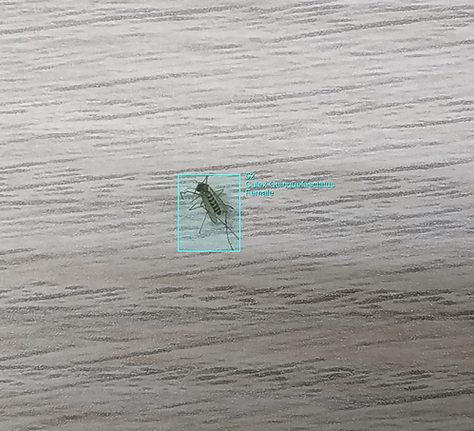
Dengue Fever Vector Prevention
Monitor vector activity and distribution for public health
Drone & Aerial Intelligence
Applicable across large outdoor environments that require wide-area inspection, monitoring, or mapping from the air

Aerial Traffic & Mobility Analytics
Analyze traffic flow, conflict points, and congestion patterns from aerial footage

Land & Agriculture Intelligence
Detect crop conditions, land use, vegetation health, and farm productivity

Utility & Infrastructure Inspection
Inspect poles, streetlights, towers, and utility assets for damage or leaning
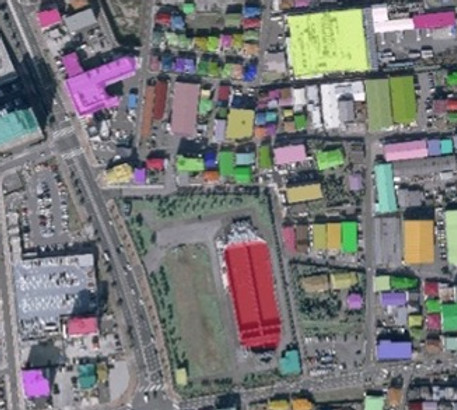
Urban Infrastructure Monitoring
Track buildings, bridges, and infrastructure for condition and change over time
Autonomous Mobility
Applicable across road and maritime environments where autonomous mobility and safe navigation are required

Driving Behavior Understanding
Interpret nearby vehicle actions to improve autonomous driving safety
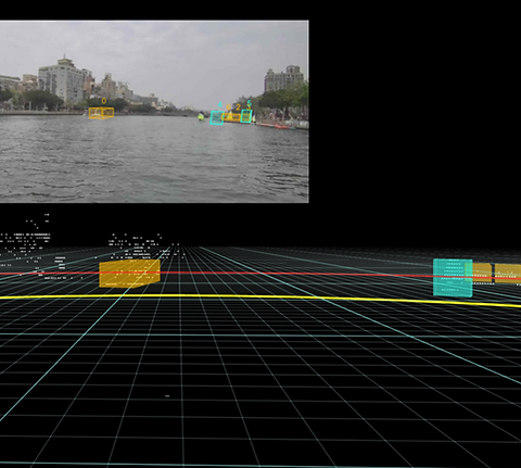
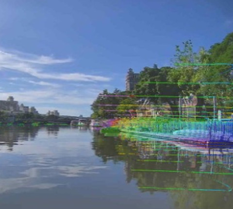
Obstacle & Vessel Awareness
Detect nearby boats and vessels with trajectory and movement awareness
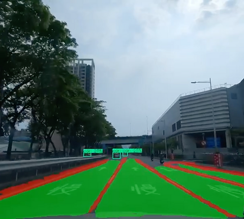
Road Scene Understanding
Recognize lanes, signs, pedestrians, and traffic context
Navigation Hazard Recognition